
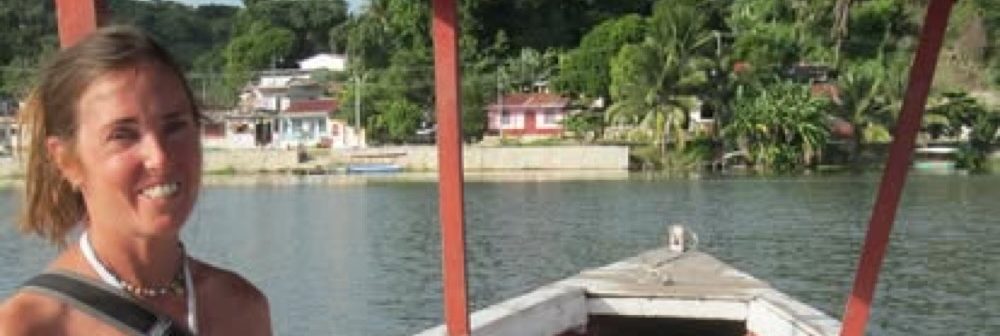
Yes, I really did. I cried when I left, that’s how much I fell in love with the Ionian island of Kefalonia (also spelled Cephalonia). After arriving on Poros on the 7:30pm ferry (we pulled in at 9pm) and having a lovely meal of spicy eggplant at the sunset taverna, I set up my tent on a long beach a few kilometers from town. I was actually 10 feet from the road, but below and at a bend so that cars had to slow down there. The next morning, I awoke and picked up trash. That’s my ritual, and I take it very seriously. It’s a drop in the bucket, but I think it makes a difference. At least I feel better about myself. I drove back toward Poros and inquired at several hotels. Most wanted 50 Euros/night. Dioni Apartments, the most beautiful of them all, had a TripAdvisor rating of 9.2 in the window (I’d never seen one that high) and only asked 30 Euros/night. A spacious apartment had a king size bed, air conditioning, balcony overlooking the sea, full kitchen, and lovely bathroom, and the young woman would clean it daily. Her father had built the entire place himself after doing a lot of hotel construction in Skala where most tourists stay. I loved it so much I ended up staying a week. I only regret that I didn’t spend more time relaxing in my luxurious surroundings. Not my strong suit.
After unloading my things (too many as usual), I drove to Poros to procure some tomatoes, cucumbers, and onions for a Greek salad. I found a lovely market stand run by a young woman. I ended up becoming a regular, and I loved that she would tell me which tomatoes, cucumbers, and lettuce were locally grown. I used the jar of olive oil given to me by my friend in Iklaina, and thus had the most important ingredient for my salad. I can’t tell you how good the Kalamata olive oil tastes. I literally drank some every day. Apparently the olive oil we buy in the US is cut with cheaper oils like safflower oil. It’s not the real deal. Using a newly acquired map, I asked her where she’d recommend going on the island. I find that’s the best kind of travel guide. She suggested I check out the thalos tomb a few miles away. It turns out her mom staffs the site.
Before leaving Poros, I walked along the sea front, had a latte, and ordered a waffle with fruit and plain Greek yogurt on top, which had become my staple. That was the life. Eating a waffle while looking out at the sea. Can’t get much better than that. I headed for the thalos tomb, and entered the tomb, listening to my footsteps echoing against the stone roof, which had been partially destroyed when it was looted. Leaving the tomb, I drove toward Sami, and stopped at a museum containing ethnographic artifacts from the surrounding villages, which turned out to be locked. Knocking on a few doors, I found a woman who said she would try to get the key, and that it was closed due to lack of interest. In many ways, that’s what I come to see on my travels.
I drove through the pretty port town of modern Sami, and up the hill of Agioi Fanendoi and Palaiokastro, where the ruins of two citadels built during the Hellenistic period and a Cyclopean fortification wall which stood north of the ancient city of Sami. Cyclopean means made of stones so large that only Cyclopes could have built it. The site also hosts an ancient aqueduct, traces of an ancient theatre, part of a Roman edifice known as Rakospito, and 3rd century BC tombs, as well as an old church with beautiful frescoes and no roof. Ancient Sami was a prosperous and powerful town founded by Agaios, son of Arkadia’s King Lykourgos. During classical and Hellenistic times, Sami flourished through trade and the exploitation of Mt. Ainos’s timber. It was one of the four ancient cities of Kefalonia.
On the way down the hill, I intersected a large herd of sheep directed by a shepherd on a scooter. Seems easier than on foot. I’ve seen shepherds on foot with a flute with no shelter in sight, to shepherds herding their flocks from the comfort of a car. I drove to Antisamos, a stunning white sand beach that I consider more beautiful than Myrtos, which has been named one of the ten most beautiful beaches in the world. I wish I’d swum, but it was dusk and I didn’t fancy a dip in 55 degree water at that time of day. I drove on to Agia Efimia, even more quaint than Sami, and walked along its seafront, admiring the yauchts docking along its quay. I found a very popular restaurant at the end of the line, made so by its inclusion in the Lonely Planet (aka gringo trail). I like guide books, but I find that when restaurants or hotels are recommended, they are invariably crowded and not as good as hole in the wall-type places. I longed for my favorite fast food chicken souvlaki pita with tzatziki (greek yogurt and garlic) and saw 2 girls eating one. I asked and quickly located the place, and quickly polished off the tasty offering. As I continued down the seaside avenue, an older gentleman waved at me. I returned the salute and he asked me to join him for a drink. I’m not a drinker but had tried mastic, a liqueur produced from the resin of the mastic tree (Pistacia lentioscus), which has traditionally been dried on Chios and is thus known as “tears of Chios”. When chewed, the resin softens and becomes a bright white and opaque gum, with a pine or cedar-like flavor. The word mastic is derived from the Greek verb, μαστιχειν (mastichein) “to gnash the teeth”, which is the source of the English word masticate. The word is a synonymous with gum in many languages.
The gentleman gave me his number and said I could stay at his place for free. He said he had paved the walkway which stretched for at least 2 miles along the sea with island limestone. Apparently he has several businesses he is involved in, though he said he is retired now. I thanked him for his kind offer but told him that I had a place to stay and that I didn’t know if I’d have time to spend time with him. I called him the next day letting him know that I wasn’t available that day. I wasn’t sure he understood.
Kefalonia is the third largest of the Greek islands at approximately 300 square miles, so I had a ground to cover. Most of the island is uninhabited or dotted with small villages, while the capital Argostoli has a population of 11,000, one-third of the island’s inhabitants. Lixouri is the second major settlement, and the two towns together account for almost two-thirds of the island’s population. Sadly, in 1953, a massive earthquake destroyed almost all of the settlements on the island, leaving only Fiskardo in the north untouched. The island has a rich biodiversity, with a substantial number of endemic and rare species. Some areas are part of the EU’s Natura 2000 network. The highest mountain, Mount Ainos at 5341 feet, is covered in fir trees. The countryside near Sami is dotted with caves: seventeen to be exact, which is unusual in Greek geomorphology. Only two of the caves are open to the public – the subterranean lake-cave of Melissani and Drogarati Caves. I went to both. I especially loved Melissani, whose waters are preternaturally blue. I’ve never seen such torquoise colored water. Except perhaps for Kefalonia’s seashore. Can you tell I’m smitten?
The following days were spent in bliss. I covered the entire island over the course of the week. One day I drove past Agia Efimia toward Myrtos beach in search of the olive oil museum. Instead, I found a small village with ruined lanes and decided to do a short trek. I noticed hiking signs and followed them to an ancient stone threshing floor (the island used to be covered in grain crops, mostly wheat and barley) and a small stone hut for cows and another for sheep. The trek continued up a steep peak, but I turned back, having collected as many burrs as my socks could hold. I suddenly realized that I no longer had my camera, and remembered that I had sat down on a rock several 100 feet back. I returned and found the camera lying on the ground. What a relief! I thanked the gods of place and nmade my way back down the trail. On the way I scared a flock of goats, causing a young kid to scurry far ahead, away from his mother. In the ensuing hour, I heard his plaintiff bleat every 10 seconds or so, followed by 15 minutes of silence. I was so traumatized by the possibility that he would never find his mom and eventually die due to the untimely flushing, that I found a vista and tried to locate him, tears in my eyes. Then I heard another bleat, and decided it must be his mom. I wondered why it had taken her so long to call back to him, but soon I spied what I took to be her and several others making their way toward the bleats of the young kid. I finally heard the kid respond, but I could not see due to dense foliage, and only hoped that they found one another. The uncertainty plagued me for several days.
I went to Argostoli on three separate days. On the first visit I met Eris, the owner of a wonderful bakery called Voskopoula. So delicious and varied were the pastries that I wrote my first ever TripAdvisot review. Eris and I talked about life on Kefalonia and Greece’s current economic state. He was very erudite and well-read and probably the most knowledgeable person I’ve spoken with about the subject. We were able to talk again on my third visit. After wandering through the town, I walked across Drepano Bridge, a beautiful stone walkway which transects the bay to create Koutavos Lagoon, a feeding ground for loggerhead turtles (Caretta caretta). I was so ecstatic to see swimming turtles. Now a nature reserve, the lagoon was once an impassable swamp and breeding ground for mosquitoes and malaria. In 1813 when British governed the island, a wooden bridge was constructed by Colonel Charles Philip de Bosset, a Swiss engineer in the employ of the British army. Four years later stone arches were added and, after some 26 years, the entire bridge was rebuilt in stone. Halfway across the bridge stands a stone column built by the British to celebrate their presence. Much like a fraternity stone that gets repainted with new colors every few weeks, various occupiers, including the Italians and Germans, have tried to destroy it.
Argostoli, like the rest of Kefalonia, was mostly under Venetian influence in the 1400s to 1800s, rather than under Ottoman rule. The coastal road west out of Argostoli was known during the Venetian period as the Piccolo Gyro (little wheel). Along the Piccolo Gyro, in the Vlikha area facing Lixouri, lie the ‘Swallow Holes’ of Katovothres, a geological phenomenon. Sea water disappears underground and travels under the island, re-emerging some fourteen days later in the Karavomylos area of Sami, having passed through the nearby, underground Melissani lake. The power of this sea water was harnessed, in 1835, to power a water mill. Further along the Piccolo Gyro is the Agion Theodoron lighthouse, named after the small adjacent church. More commonly known as the Fanari lighthouse, this too was built during British occupation.
My next visit to Argostoli was to visit the Korgalenio Historical and Folklore Museum. This collection, made up primarily of family hierlooms collected after the devastating earthquake that levelled the island in 1953, houses everyday objects of people of Kefalonia, furniture, tools, appliances, artwork, religious artifacts and historical documents. It was created in 1963 on the ground floor of Korgalenios Library and covers the entire modern history of Kefalonia from the Venetian conquest until 1953. The permanent exhibition is divided in sections of urban and rural, ecclesiastical art and urban design. The collection of Byzantine icons of Charokopos and the Collection of Francis and Stephen Vallianos are exhibited separately. I really got the feeling that I was visiting a local home from the past, not a museum. I made friends with Thea, the curator who became friends with the elderly British woman who started the museum. She used to live in New York City and talked about life on the island and the pros and cons of living in Greece vs the US. I felt her to be a kindred spirit (as I did many of the people in Greece), and hope to visit her when I return.
The third time in Argostoli I visited the Fanari lighthouse, the beautiful beach of Lassi, and the monument to the massacred Italian 33rd Acqui Infantry Division by the Germans in Argostoli in September 1943, following the Italian armistice. After the Italian government negotiated a surrender with the Allies in 1943, the German Army tried to disarm the Italians in Operation Achse. 1315 Italian soldiers were killed in battle, 3,000 were drowned when the German ships taking them to concentration camps were sunk, and 5,155 were executed. It was one of the largest POW massacres of WW II, along with the Katyn massacre of approximately 22,000 Poles by Soviets.
From Argostoli I drove toward Lixouri. Maybe it was my imagination, but it seemed that the gas gauge plummeted after the quarter tank mark. Suddenly I was on the twisty road with pummice stone above and no town, let alone village, in sight. I followed a sign for a gas station and saw none. I drove in random directions hoping that I would run into one before running on empty. Finally, desperate, I drove up to a small village where a woman had told me there was a station (there wasn’t) and found 3 older men sitting on the side of the narrow road. I stopped and used the few words of Greek I knew to indicate that petrol was low. I pointed to the gauge. They understood. One had been a ship captain (as it seems a large proportion of the island’s male inhabitants had been), and he spoke English. It turned out one of them had a spare few litres, and I was able to make a kind of funnel by sawing my plastic water bottle in half. This wasn’t adequate however, and another found an actual gasoline funnel. These guys were prepared! I was so grateful and asked whether I could offer money, but they refused. That spirit of sharing and kindness continues to be a surprise to me. I hope it stays eternal with these good people. Because of them, I was able to continue to Lixouri, where I saw the red sand beaches along its southern shore. There’s a ferry that runs there from Argostoli, because the drive is long (1 hour) vs a 10 minute ferry hop. I refilled my water bottles and walked along the seafront taverna strip near the ferry boarding area, then headed home to Poros.
I drove to Skala and was saddened by the morasse of resorts spreading toward the unfettered beaches of Poros. The sprawl continued more or less unbroken to Argostoli 15 miles away. I think it’s a recent phenomenon (the last 10 years) and doesn’t bode well for the fate of Kefalonia. Hopefully the building will stay in this region. I walked around the older part of town and discovered a 2000 year old Roman villa with impressive intact mosaic floors, a rarity in Greece. It’s located on a river next to the sea – an ideal vista for a Roman patrician. The site was closed, but that didn’t deter me. I jumped the fence and walked on the gang planks which protect the floor from foot fall. Several tourists walked by, expressing disappointment at the closed site, and I encouraged them to follow my lead. They did and were very happy for it.
From Skala I drove to the Venetian Castle of Saint George 7 km south east of Argostoli, above the village Peratata. It was built in the 12th century by the Byzantines but it was the Venetians who built its external walls in 1504, giving it its present polygonal form. The state of the castle’s ruins was caused as much from the earthquake of 1953 as war, occupation, and time. At the height of its glory, the castle walls housed a town complete with residences, public buildings, storehouses with food and guns, churches, hospitals, prisons, and cisterns of water. It was the capital of Kefalonia before Argostoli was made the new capital in 1757.
From the castle, I drove down towards below Peratata to a small village and alighted, looking for my chicken souvlaki treat. The souvlaki place was just getting the charcoals glowing (the old and much more savory way of cooking souvlaki) and wouldn’t be open for another hour. Most restaurants and cafes don’t open till 5pm. Across the way there was a commanding view of the sea through the branches of a 100+ foot tall sycamore. A beautiful old 2 story stood next to it, with the sign Cafe Platano. Sycamore is Platanus occidentalis, with Platanus derived from the Greek word πλάτανος (platanos), meaning flat, and occidentalis from the Latin meaning “of the west.” And the word sycamore is derived from the ancient Greek συκόμορος (sūkomoros) meaning “fig-mulberry”. It was 4pm, too late for coffee, which seemed to be the cafe’s speciality. I was interested in the notice the Welshman who owned the cafe had posted in his window about the current economic woes. He is a Greekophile who had married a Greek woman and moved to Kefalonia more than 20 years ago. He bemoaned the development of the island and the sale of Greek land to foreigners due to illegal manuevering by Greek banks forcing early repayment of mortgage loans. He’s particularly fond of scales and has a tremendous collection in his shop, which he bought from Romany people on Kefalonia still in the metal business.
I couldn’t forget the promise I made Nick Fernentinos’ niece and nephew to visit Komitata, the small village where his mother was born. I looked for it in vain when I visited Agia Elfimia, but it is such a small village that it didn’t appear on the map of the island. It is said that the people of Komitata and north are unusually kind, more so than those of the south. Nick’s father was from a neighboring village, but I didn’t know the name. When I visited the church yard cemetery of Komitata, it was full of tombstones with the name Ferentinos, his father’s name, as well as Fioratos, his mother’s maiden name. Komitata is isolated on a high promontory next to the sea, and access is treacherous. The town currently numbers 50 at most. There is a seaside resort at the base that many tourists visit, blowing by Komitata in their haste. I asked at the only place where I saw people, a cafe, which a man from Argostoli runs in the summer season. He offered me a homemade limoncello, and I asked him if he knew anything about Nick’s parents. We walked to the gate of the oldest resident, who hobbled out. He explained who I was looking for, but the man needed their date of birth, first names, and when they left for the US. I will have to get back to him.
I pressed on toward Fiskardo, whose architecture most closely reflected an authentic Kefalonian village, as it was untouched by the 1953 earthquake. On the ferry to Kefalonia, I’d met Haris, the owner of an expensive resort in Fiskardo named Emelisse (330 Euros a night), who bemoaned the laziness of his daughters’generation. He was watching a television program showing footage of Albanians taking people hostage, which happened 15 years ago (I wondered about the timeliness of the airing). He commented that his Albanian employees are more reliable and hard-working than the Greek staff, and that his daughters would rather sell family land than work.
I found Fiskardo to be charming, albeit full of tourists with no locals in sight (except as restaurant wait staff). I was catching the ferry back that day, sadly, so I didn’t have much time to explore. The sea looked amazing, as all parts of Kefalonia do, and I was tempted to jump in. I walked amongst the ruins of Roman baths toward the main restaurant area built right on the large marble stones that marked the harbor. I had hoped to visit Asos, another beautiful town graced with a castle, but ran out of time. Next visit. I raced back to Poros, making it in an hour and half (probably setting a record), and packed my things. I thanked the kind owners of Dioni Apartments, leaving them a load of perishables that I didn’t have the ability to keep cool. I had purchased a ticket earlier that morning, so I made my way to the ferry directly. There I sat, with notebook in hand, writing down my fleeting memories of Kefalonia . And started to cry.
I have to share Cavafy’s poem Ithaka here, as it is both the island next to Kefallonia, and many Greek archeologists say a reference to Kefallonia itself:
As you set out for Ithaka
I arrived in the mainland port of Kyllini at 6:30pm with plenty of daylight to explore, and made my way down the rather confusing roads toward the hilltop Crusader fortress of Chemoutsi, situated on the highest point of the peninsula. The fortress dominates the landscape, and I was disappointed to find that it and the associated museum was closed for the day. An annoying loud speaker continuously bellowed that it detected human presence and that I was being surveilled. Oh joy. I simply wanted to walk the perimeter of the site and peer in through the castle gate to get a feeling for the place. I read the following from an information kiosk nearby: it was built in the early 1220s by the Frankish crusaders from the despotate of Morea (the Principality of Achaea) as their main stronghold, and is perhaps the finest fortification of the early period of Frankish rule in Greece preserved in the country today. It has a central hexagonal keep, built around an inner courtyard and contains two-storeyed halls along its entire length and an outer wall enclosing an outer yard on its western side. The castle is largely preserved in its original 13th-century state, with only minor modifications for artillery installation.
Located near the Principality’s capital of Andravida and chief port of Glarentza Chlemoutsi played a central role in the Principality’s history, but was never actually besieged. After coming under Byzantine rule in 1427, it was captured in 1460 by the Ottoman empire, along with the rest of the Byzantine Despotate of the Morea. In Ottoman times, minor additions were made to provide platforms for artillery, but the castle progressively lost its significance and was completely deserted by the late 18th century. In 1825, during the Greek War of Independence, part of its outer wall was demolished to prevent Greek freedom fighters from using it. From the fortress I drove south along the coast through agricultural lands to Loutra Kyllini (or Linzi – Litzi meant bath in Latin), known from ancient times for the thermal springs where their water, vapors and mud were used to heal arthritis, asthma, and skin conditions.
The area is densely vegetated with eucalyptus from France planted in the 1890s by the Railroad Organisation of Peloponnese (SPAP), which developed the thermal baths as a business. In 1880, under Trikoupis premiership, the baths were given to SPAP, who built a hotel and a spa with 50 marble bathtubs, inhaling treatment, nose and ear cleaning, larynx spraying, flower gardens, and other accommodations. During the German occupation and the civil war, the facilities were destroyed. In 1951 EOT, a Greek Tourism Organisation, recreated the spa, hotels and camping area.
I planned on going to ancient Messini (Messene in Greek) the next day, so I camped on the beach near Kyparrisia. The next morning I stopped by the bakery that had helped me find the temple of Apollo Epicurius, but no one was there. It was a Sunday, and I continued up the hill to my favorite cafe for a latte with a view before heading to the old watermill in Myloi which I’d visited before. Myloi means mills in Greek, as the main occupation in that area used to be olive oil processing and flour milling. I instantly fell in love with the mill. Maybe it was knowing that it had been a center for Greek resistance against Nazi occupation during WW II. Maybe it was the fact that it is a working mill that still makes its own flour. Or the fact that the locals love it, as evidenced this Sunday when everyone from little old ladies to young people and dapper gentlemen congregated in the lovely garden cafe. Detailed explanation of how the mill works and references of background history are happily offered by the mill’s crew on the spot. It is both an educational experience and a visceral one. I highly recommend it.
I continued on the road toward Messini on back roads and through small villages. Within half an hour I had reached a Cyclopean gate of megastones, which turned out to be the Arcadian gate and 3 guard towers on either side (Arcadia was the northern enemy of the ancient Messinians). What a monumental and impressive sight! I got out of the car and examined the marble sarcophagi near the entrance, then walked into the inner chamber where you could hear your own breathing, the stones echoed so faithfully. Messini was originally encircled by a circuit wall 5.6 miles long, 23 feet wide, and 30 feet high. It was fortified by 30 square or horseshoe-shaped guard towers (and probably barracks) with doors admitting passage to a protected walkway on top of the wall. The wall was pierced by two main gates flanked by protective structures and rectangular in shape with a lintel of a single, massive beam of limestone. Through the Arcadia Gate to the north ran and still runs the main road north (to Arcadia), currently from Mavromati. As Mavromati is the location of the major spring klepsydra, it was probably first stop for travellers to the city. From there a road runs over the ridge adjoining Mount Ithome and Eva to the Laconia Gate, similar to the Arcadia Gate. The wall runs straight up the ridge but does not encompass Mount Eva. Now, the next stop is the monastery, Mone Voulkanou, set into the lower southeast flank of Mounts Eva, where the sanctuary of Zeus had been built when Ithome, which predates Messini, existed.
I drove past the very pretty touristic village of modern Messini but didn’t see the ancient site. I found the Klepsydra spring and drank from it, then turned back and drove toward the summit of Mt. Ithome and the Laconia Gate, of which only a small portion remains in comparison to the massive, impressive Arcadian gate. Then I drove back through the town and noticed an official looking building on the left. It was the museum. The site turned out to be a few 100 meters below. I ended up spending five hours there, which was a feat considering that it was a humid 100 F. The museum findings were small and unimpressive – a few headless Roman marble statues of toga-covered torsos. Nevertheless, I found the site itself to be far more interesting than Olympia, my favorite parts being the Arcadian gate, the stadium and the tomb of Aristomenes. Pausanias wrote a description of the city’s temples and statues, springs, marketplace and gymnasium, Asclepieion, altars, tomb of the hero Aristomenes, and the temple of Zeus Ithomatas on the summit of the Acropolis with a statue by the famous Argive sculptor Ageladas, originally made for the Messenian helots who had settled at Naupactus at the close of the third Messenian War. In addition there is a theatre, stadium, council chambers or Bouleuterion, and a market propylaeum, while on the shoulder of the mountain are the foundations of a small temple, probably that of Artemis Laphria, which I was told was too difficult to access.
Satisfied after a full day of archeologizing, I made my way back to Kalamata, where I hoped to visit with my friend whose wedding was the next day and find a good home for some of the food and other items that I couldn’t take with me on the plane from Athens to Budapest.
